
Melissa’s slow pace and humid conditions have prompted concerns across the region, with forecasters warning that it could dump extreme amounts of rainfall and lead to life-threatening flash floods and landslides.
Current Path and Forecast
As of this weekend, the center of Melissa is positioned south-southeast of Kingston, Jamaica, moving very slowly at around 1–2 mph. Forecast models predict a potential landfall or near-landfall in Jamaica early next week before the storm tracks toward eastern Cuba and possibly the Bahamas.
The National Hurricane Center notes that the storm’s projected path remains uncertain, and neighboring territories could experience severe conditions even if they are outside the direct forecast cone.
Threats and Impacts
Heavy Rainfall and Flooding
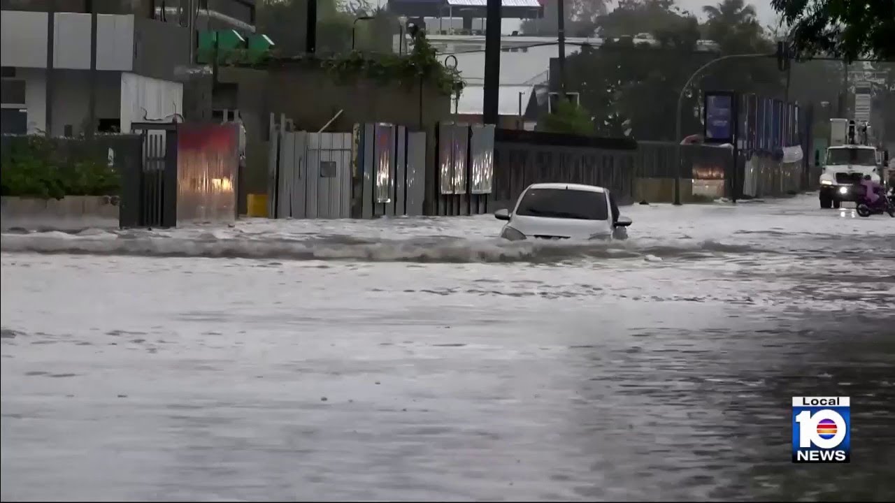
Meteorologists are warning of dangerous rainfall totals across Jamaica, southern Haiti, and the Dominican Republic. Forecasts estimate between 8 and 14 inches of rain, with some regions potentially seeing more than 25 inches. Such levels could trigger flash floods and mudslides in mountainous areas, especially where soil is already saturated.
Wind and Storm Surge
Melissa is expected to strengthen into a Category 1 hurricane and could reach major hurricane status as it tracks across the Caribbean. Sustained winds above 74 mph, dangerous gusts, and coastal storm surges are possible. Even outside the storm’s core, strong tropical-storm-force winds may cause damage and coastal flooding.
Slow Movement Increases Risk
Because Melissa is moving unusually slowly, rainfall could persist for days in the same areas, greatly increasing the risk of flash flooding. The storm’s behavior is similar to past systems that caused catastrophic impacts due to stalling over warm ocean waters.
Regions of Highest Concern
- Jamaica: Facing potential direct impact, with flooding and landslides as primary threats.
- Haiti and the Dominican Republic: High flood risk, particularly in southern and mountainous zones.
- Eastern Cuba and the Bahamas: Likely to experience secondary effects later in the week depending on Melissa’s movement.
- U.S. Mainland: No immediate threat at this time, but long-range models continue to monitor potential shifts.
Safety and Preparedness
Authorities urge residents to prepare now. Key safety steps include:
- Monitoring reliable weather updates from national meteorological agencies.
- Assembling emergency supplies including water, food, medications, and important documents.
- Identifying local shelters or higher-ground locations in case of evacuation orders.
- Securing outdoor items and preparing for power outages.
- Staying indoors during high winds and avoiding floodwaters at all costs.
Why Meteorologists Are Concerned
Melissa’s slow motion and the current high sea-surface temperatures are creating prime conditions for intensification. Experts warn that even if the storm does not reach Category 3 strength, its slow progress means extended exposure to high winds, rainfall, and coastal flooding — potentially causing major infrastructure and agricultural damage across the Caribbean.
Editor’s Note
This article is provided for informational purposes. Presence News urges readers in affected regions to follow official advisories and instructions from local authorities as Tropical Storm Melissa continues to develop. Presence News sends article to reader who has family in Jamaica – shoutout Christopher.
Sources
- National Hurricane Center
- Associated Press
- Weather.com – Tropical Storm Melissa Updates
- Live Science – Melissa’s Slow Movement Threat
- CBS News – Forecast Maps & Projections
- Gulf Coast News Now – Forecast Discussion