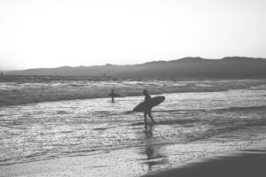
Hurricane Marie is remaining hundreds of miles offshore, but Southern California is still feeling its effects as tropical moisture brings rain to Los Angeles and Ventura counties while powerful swells produce large waves and huge surf along the coast.
LOS ANGELES — September 6, 2026 — A distant hurricane in the Pacific Ocean is making its presence known across Southern California this weekend.
Hurricane Marie is not expected to make landfall in California, but moisture associated with the storm has helped bring widespread rain across portions of the Los Angeles area Sunday while swells generated by the hurricane are producing large waves along the Southern California coastline.
The National Weather Service Los Angeles/Oxnard said Sunday afternoon that rain associated with the distant tropical cyclone would continue into the evening, with the greatest focus across Los Angeles County and portions of Ventura County.
The unusual September weather comes during what is normally one of Southern California’s driest times of the year.
Rain Spreads Across Los Angeles and Ventura Counties
Light to moderate rain was falling across much of Los Angeles and Ventura counties Sunday morning and afternoon.
By Sunday morning, many locations in Los Angeles County had already received approximately 0.10 to 0.33 inches of rain, according to the National Weather Service, while some locations in the Santa Monica Mountains had received more than half an inch.
Forecasters said widespread storm totals of approximately 0.25 to 1 inch were likely across much of Los Angeles County, with similar amounts potentially extending into eastern Ventura County.
Some south-facing foothill locations in the Santa Monica Mountains and San Gabriel foothills could receive locally higher totals approaching 1.5 inches as terrain helps enhance rainfall.
Although those numbers may appear modest compared with major winter storms, even relatively light rain can create problems after Southern California’s long dry season.
Oil and other materials accumulate on roads during extended periods without rainfall. When the first rain arrives, road surfaces can become particularly slick.
Locally heavier bands of rain could also create isolated flooding problems.
Hurricane Marie Remains Far From California
Despite its effects on Southern California, Marie itself remains far offshore.
The National Hurricane Center reported early Sunday that Marie had maximum sustained winds of approximately 90 mph and was moving northwest.
The National Weather Service reported Sunday morning that the hurricane was approximately 770 miles south-southwest of Los Angeles.
Marie is expected to remain well offshore as it moves over progressively colder ocean water and weakens.
That distance illustrates how a hurricane does not need to make landfall for people hundreds of miles away to experience its effects.
Tropical systems can transport moisture across large distances while simultaneously generating ocean swells that travel far beyond the storm itself.
Along the Southern California coast, those waves may be one of Marie’s most noticeable impacts.
Large Waves Arrive Along the Southern California Coast
Hurricane Marie has generated a substantial south to southeast swell that is reaching Southern California beaches.
The National Weather Service said swell heights of approximately 5 to 7 feet with periods around 13 seconds were moving into coastal waters.
As those swells reach shallower water near shore, they can develop into substantially larger breaking waves.
South-facing beaches in Los Angeles and Ventura counties are expected to experience breaking waves of approximately 5 to 8 feet, with local sets potentially reaching 10 feet.
Some of the strongest surf is expected through Monday, while hazardous beach conditions are expected to continue through at least Tuesday.
For experienced surfers, the arrival of a hurricane-generated swell can produce unusually large and powerful waves.
But larger surf also brings considerably greater danger.
Big Surf Also Means Dangerous Rip Currents
The same conditions producing large waves for surfers are creating potentially life-threatening conditions for swimmers and inexperienced beachgoers.
The National Weather Service has issued a High Surf Advisory and Coastal Flood Advisory through 11 p.m. Tuesday for the Malibu Coast, Los Angeles County beaches, Ventura County beaches and Catalina and Santa Barbara islands.
Forecasters warn that widespread and very strong rip currents could pull swimmers and surfers away from shore.
Large breaking waves can also unexpectedly wash people from beaches, rocks and jetties.
The National Weather Service recommends remaining out of the water during dangerous surf conditions or staying near a lifeguard.
Even experienced surfers should recognize that hurricane-generated surf can behave differently from ordinary beach conditions. Larger sets, stronger currents and changing conditions can increase the difficulty of returning to shore.
High Tides Add Another Problem
Marie-generated swells are arriving at the same time that high tides are increasing along the Southern California coast.
That combination raises the possibility of coastal flooding.
Areas considered particularly vulnerable include Long Beach, Avalon, Point Mugu, portions of Malibu and other low-lying south-facing coastal areas.
The National Weather Service said high tides are expected to reach approximately 7 feet Monday evening and 7.2 feet Tuesday evening.
When a large incoming swell coincides with an unusually high tide, waves can push water farther inland than they otherwise would.
Parking lots, beaches, walkways and other low-lying areas near the ocean could experience flooding.
Beach erosion is also possible.
A Hurricane Can Affect California Without Ever Reaching It
California is not typically associated with hurricane landfalls in the way Florida, Texas or other Gulf and Atlantic states are.
Cold ocean water along much of the California coastline generally makes it difficult for tropical cyclones to maintain hurricane strength as they approach the state.
But storms do not have to reach California to influence its weather.
A hurricane hundreds of miles offshore can send swells outward across the Pacific. Those swells can travel enormous distances before reaching beaches.
Tropical moisture can also become drawn northward and interact with other atmospheric systems, bringing clouds, humidity, thunderstorms or rainfall into Southern California.
Marie is providing a particularly visible example of both processes at once.
Inland, residents are seeing an unusually wet September Sunday.
Along the coast, surfers and beachgoers are watching powerful waves generated by a hurricane they may never actually see.
Conditions Expected to Improve, but Surf Will Remain
Rain across Los Angeles and Ventura counties is expected to gradually diminish Sunday evening.
Marie itself is also forecast to weaken as the storm moves over colder Pacific waters.
The National Hurricane Center expects the hurricane to weaken into a tropical storm and eventually become a post-tropical system as it continues northwestward over the Pacific.
But ocean swells do not disappear immediately when a hurricane weakens.
Hazardous surf, strong rip currents and elevated coastal flooding concerns are expected to remain along portions of the Southern California coastline through Tuesday.
For surfers, Marie may deliver some of the largest waves seen along south-facing beaches in recent days.
For everyone else heading toward the water, those same waves come with an important warning.
The hurricane may be hundreds of miles away.
Its power can still reach the California coast.
